Ken posted a proposed trip into the BC interior that took us to Bella Coola and through some roads that are well-known for their curves and scenery. At first everyone got excited and then as the time ticked down from months, weeks and then days, people kept dropping out. In the end it was Ken and Greg G; Neil would have gone but his home was in danger from a fast moving large forest fire that week. Luckily, his home was spared!
Ken traveled about 4000 km on this trip and I about 4600 km because I started in Edmonton (10 day trip for me, 8 days for Ken). I was handicapped because I let my passport lapse but we got a trip just in BC that was worth it.
The Roads we took.
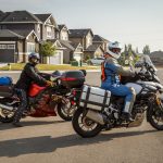
Leaving Ken’s place in west Calgary for the Sept 2017 trip. This is the second season of this V-Strom and Ken’s second V-Strom.
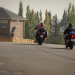
Finally on our way to Sicimous.
On the way back from my favorite road in BC, Kaslo – New Denver. That was right after cruising my second favorite road, New Denver – Kaslo!
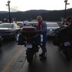
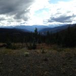
Somewhere ? Ken will know!
On our way to Williams Lake we stopped on Hwy 24. There was smoke in the air but no sign of fire yet.
Hwy 20, just outside of the town of Williams Lake. The road climbs up and out of the river valley.
Different view from same spot on the north side of the newer bridge.
Fire burned both sides of the road here.
Fire, put out.
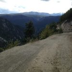
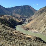
That squiggly line in the middle of the frame is the gravel road to Bella Coola in the Tweedmuir Recreational Area.
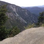
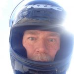
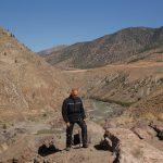
On a rock to gain a couple of feet visual advantage!
For several kilometers there is a “wall” where there is no guard rail. It was raining lightly and the mud was soup; I won’t have it any other way!
Another view of the road through the Provincial park.
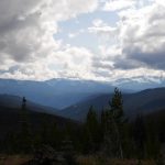
The mountains appear to get bigger as we get closer to Bella Coola (~60 kms).
Almost at Bella Coola we stopped at a station that photographers got access to bears feeding, it was an electrified pen for the people! We missed the bears but this moose was stopping his own photo crew. He was romantically approaching the cattle and getting rebuffed each time!
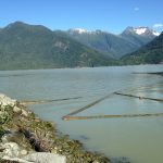
Bella Coola is in a fiord and is almost a 100 kms from the coast. Here is a closed fishing operation, the most common trade is tourism.
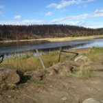
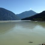
The ferry docking at Bella Coola, without a ferry.
A different view of the terminal.
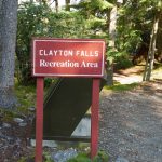
Continuing on Hwy 20, it goes through Clayton Falls Rec Area …
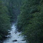
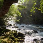
Clayton Falls and the stream resulting from it, taken from a bridge.
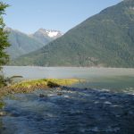
Stream exit
A log-boom keeping a few logs from being in the way of water traffic. Also it is the seaside view from the end of Hwy 20.
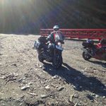
Ken parking his bike because we have no place to go! Hwy 20 ends.
Another view of the sea from the end of Hwy 20 and just further than Clayton Falls.
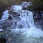
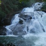
Clayton Falls in the distance.
The Falls
Art!
Confirmed.
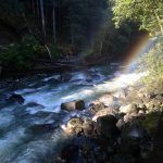
The Falls taken with a different F-stop setting.
Oops! Damn cell phone switched cameras on me!
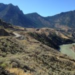
Looks like an Alien Pyrimid from the highway! Hwy 99 before Lillooet.
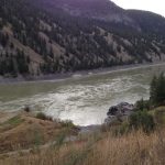
The second of three separate crossings of the Fraser river. Note the different environment from the previous crossing at Williams Lake.
Upstream look at the Fraser river at Lillooet crossing.
Note the road as it follows the river for this portion of the ride. Hwy 99, also known as Duffy Lake Road, is a lot busier now than when I first road it in 1999. Now there are oodles of motorhomes swarming the roads.